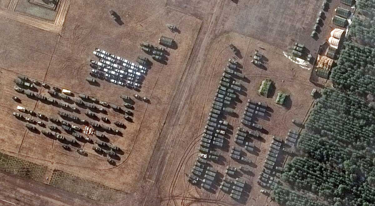
Satellite imagery shows another 100 pieces of military equipment and dozens of military tents in southern Belarus, close to the border with Ukraine. This was reported by the private American company Maxar Technologies. However, as one of the journalists noted, the movement of Russian troops can be tracked by any user of Google Maps.
On January 21, Russian President Vladimir Putin signed a decree recognizing the independence of the separatist regions of Ukraine – Luhansk and Donetsk, as well as an agreement on cooperation with them. Yesterday the decree was ratified by both chambers of the Russian parliament. The Federation Council gave permission to Vladimir Putin to use the army outside of Russia.
In connection with the entry of Russian troops into the territories occupied by separatists, the National Security and Defense Council of Ukraine recommends introducing a state of emergency for 30 days. It must be applied throughout the country. Council Secretary Alexei Danilov said that the country’s president could extend the state of emergency with the consent of parliament. He added that in the event of an invasion by Russian troops, martial law would be introduced.
“In principle, you can follow the movements of any army”
The photographs published by Maxar Technologies show, among other things, a newly built field hospital. Others should have transporters with heavy military equipment. The commander of the Security Service of Ukraine (SBU) in the Kharkiv region, Roman Dudin, also said that there was a concentration of Russian troops on the border with the region.
Ronald Lieve, on the other hand, noticed that orange and red patches can be seen on the border with Ukraine, which indicate heavy traffic or traffic jams on Google maps. Since the columns carrying heavy equipment move slowly, they paralyze all traffic around. “When you have Google Maps, you don’t need a lot of money and intelligence services. In the 21st century, every soldier has a phone in his pocket, so you can practically follow the movements of any army,” he said.
Fancy cork
“Google collects not only GPS data from the phones of soldiers, but also from all drivers driving on a given road. This is enough to generate information about unusual and loaded traffic. This traffic jam moves slowly across Google Maps, documenting the route of the army.”
Another netizen said that “it’s strange to live at a time when I can find Russian military trucks on Google Maps.”

